Ancient Ash What The San Juan Islands Can Teach Us About Wildfires
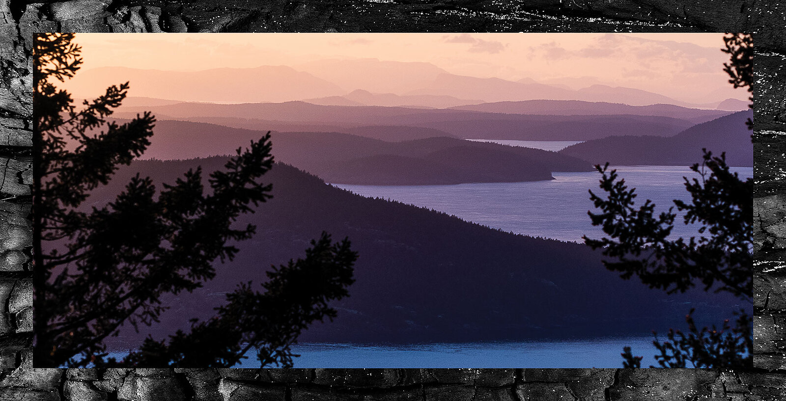
What makes a temperate rainforest? Ferns, firs and moss, surely. The smell of wet cedar and tacky dirt; the quintessential drizzle, the suffocating fog, light refracting through old man’s beard.
There is the staggering green, the mild climate, maybe a light smell of saltwater.
What is less often associated with these ecosystems is fire—its presence is hardly considered and rarely seen in forests west of the Cascades. But these places were formed by fire as much as they were by glaciers and rain—fire is essential for clearing underbrush, for bringing nutrients to the soil, for encouraging native plants to grow. Yet fire’s fingerprint isn’t visible in many of the places in which we recreate, its legacy wiped out by logging, replanting and fire suppression. But on Orcas Island, Washington—along popular biking and hiking trails and amid sweeping views of Mount Baker and the San Juan Islands—unlogged forests preserve the evidence of fire’s enduring presence.
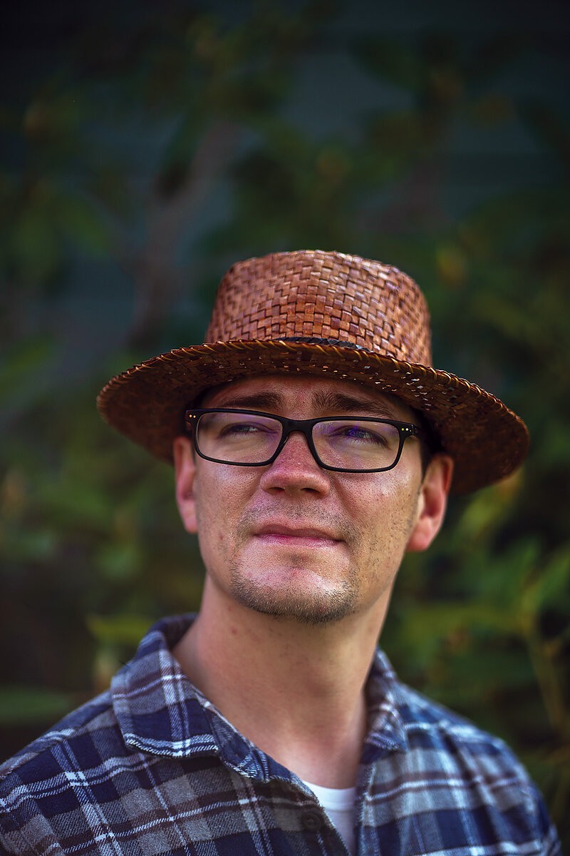
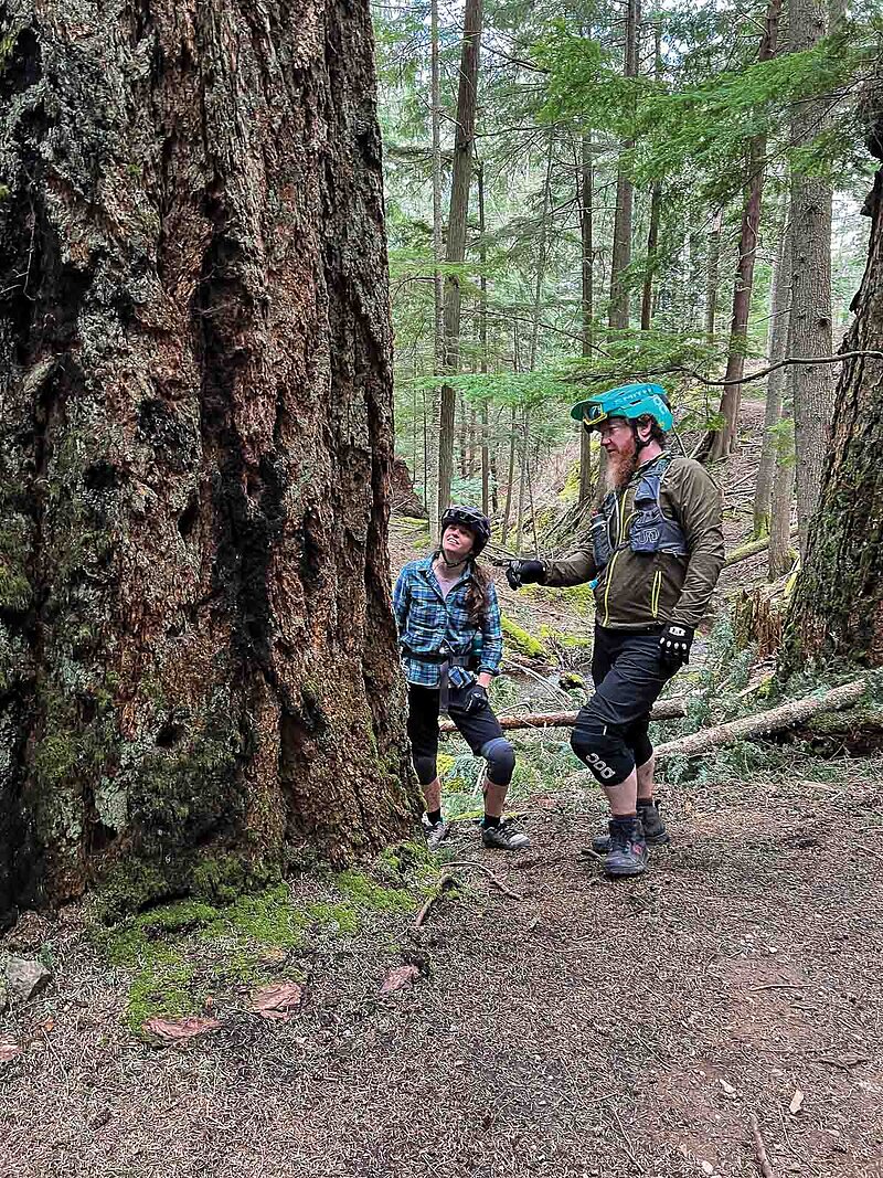
Carson Sprenger, a fire ecologist who lives on Orcas, has a deep understanding of the way fire has influenced these landscapes. Tall with a wispy red beard you could probably spot from a mile away, Sprenger has the distinct but hard to articulate appearance of having spent a lot of time in the woods. This vibe is well-supported by his background—he did fire research in the San Juans as part of his master’s degree and now owns Rain Shadow Consulting, an environmental consulting firm on Orcas where he splits his time between ecological restoration work and, somewhat adjacently, climbing trees. His background makes him one of the foremost local experts on the natural history of Orcas, and he quickly demonstrates his expertise while on an impromptu fire history mountain bike tour of Moran State Park in early April. While stopped on an otherwise unsuspecting switchback en route to the Mount Constitution summit, Sprenger describes a patch of trees in front of him from his hardtail.
“This is a pretty good patch; I’d guess some of these trees are 300, maybe 400 years old,” Sprenger says, noting the abundance of old-growth trees. He points out that sunlight is reaching the ground, which is notably free from brush though very mossy. Besides the steep cutbank, you could probably walk the length of what we can see from the road without having to step over a single downed tree or tromp through any brush. Some smaller trees are interspersed, but the large trees overwhelm the scene and there aren’t many of them, perhaps a few dozen. They’re well-spaced, meaning their canopies have room to grow. This is about as close as it gets to what this type of forest may have looked like presettlement—that is, before logging, development and fire suppression.
Moran State Park is notable to Sprenger because it’s never been logged. In fact, it’s one of only a few tracts of contiguous unlogged woods in the entire Puget Sound region. The park provides insight into what land may have looked like prior to European settlement, but it also offers an opportunity to simply gawk at old-growth trees—a rarity in the West Cascades, which were almost entirely cleared of their Douglas firs and cedars to begin building cities and towns across the Pacific Northwest in the 1800s and early 1900s. Moran was spared, but that very protection from logging also resulted in protection from an essential process that had forged these magnificent stands of old growth: wildfire.
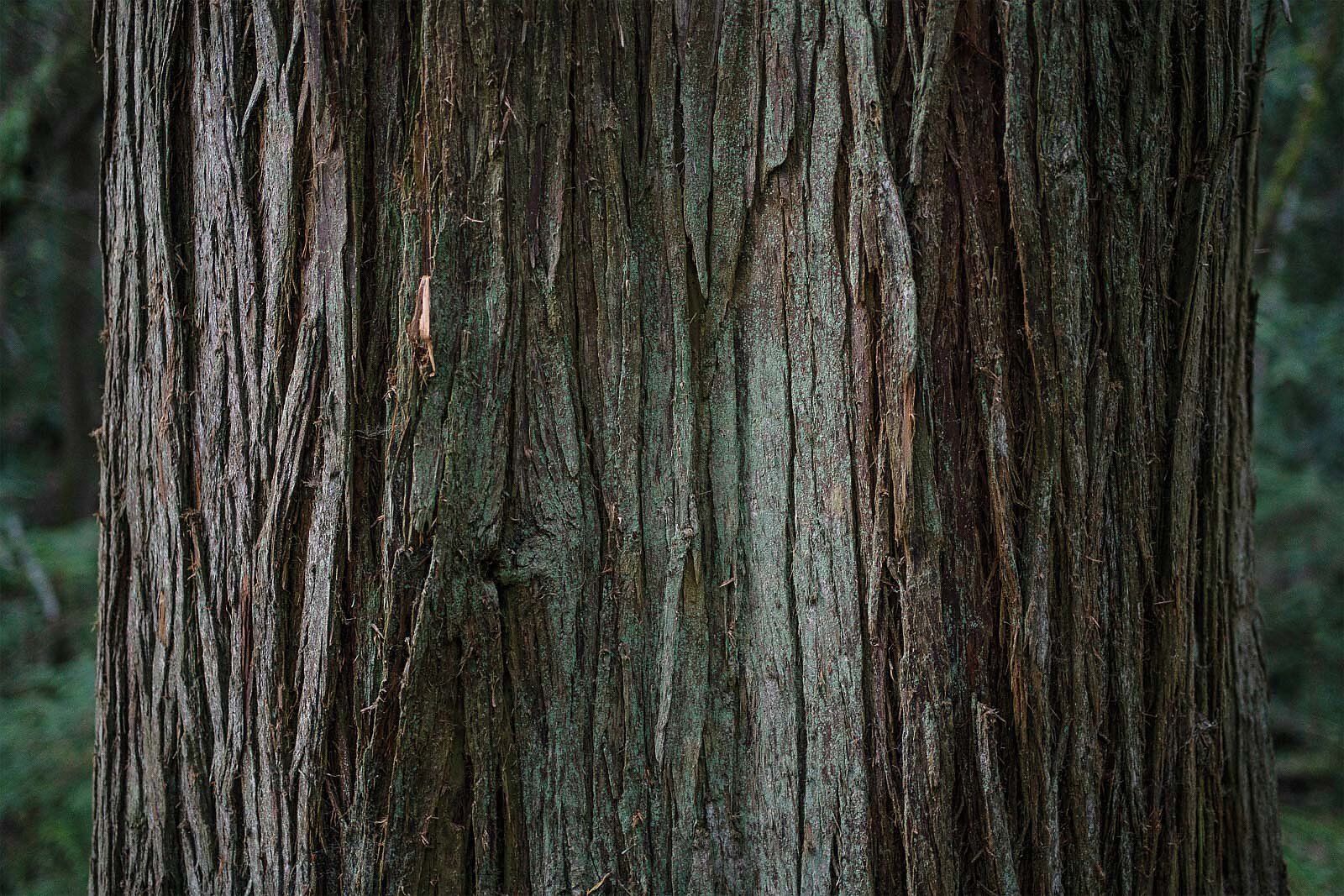
Research shows that at least seven big fires occurred across much of the park from the early 1700s until 1893, with an average of 31 years between each blaze. Until about 125 years ago, this old growth was deeply intertwined with fire, its life history practically interwoven with it. That coexistence is still written in ash on the bark of some of the largest Douglas firs, held deeply in the soil’s composition and faintly visible in the very forest structure that Sprenger talks about almost aspirationally—a bastion of what was, of what could be, if only there were more fire.
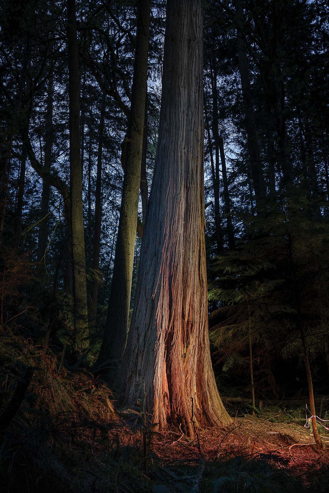
Nearly every large Douglas fir Sprenger points out has signs of fire at its base—the deep ravines of 400-year-old bark colored black with century-old ash. To find less explicit signs of fire, Sprenger must read between the lines, looking instead for the forest architecture that fire leaves: forests not overrun with brush, undergrowth or downed trees, with ample space between the large firs and cedars, and interspersed younger trees that will take over for the oldest ones when they fall to wind, decay or, well, fire.
Farther up the road—on the steep switchbacks that contain much of the elevation gain on the climb to the summit—Sprenger points out stands of happy trees, or those growing well-spaced on a sunny south face, which make their homes in micro ravines, divots or drainages with ample access to water. These trees are opportunistic and they look the part; many of them are enormous, stately things with massive branches forming their own micro forests the farther into the crown your eyes venture.
Sprenger doesn’t know the exact cause of the fires near the top of a plateau where the road moderates before its final ascent to the summit of Constitution. But he can make some educated guesses, and those guesses are supported by Coastal Salish history and a small pool of fire research done on Orcas throughout the past 40 years. Both suggest that burning by the indigenous tribes of the Salish Sea—the Lummi, Samish and other Coastal Salish tribes—was largely what kept fire in these forests until settlers put an end to this burning at the turn of the 20th century. Of all the ecological benefits of fire, its most advantageous characteristic for Coastal Salish tribes was the renewal it brought to the land, and how it encouraged new growth of plants like camas, garry oak and chocolate lily—all culturally important species that supported the tribes’ food stores during winter months.
“We use fire to promote all three of these terrestrial plants,” says Sam Barr, a member of the Samish tribe, whose ancestral lands include the San Juan Islands. “It also encourages new nutrient recycling between the prairies and the nearshore environment, which would promote kelp forests and eelgrass beds, which would then boost all of your crabs, clams and your salmon nurseries.”
Barr’s comment illustrates that fire doesn’t just equate to burnt ground. For many tribes across the West, rather, it’s a refresh, a rebalancing, a critical process in the vitality of a place.
Sprenger suggested these burns could have happened annually, and that evidence acquired through research and tree ring samples indicates that lightning fires were relatively rare (or otherwise difficult to discern). Barr confirmed Sprenger’s suspicions, referencing the Coastal Salish’s practice of burning annually to encourage plant growth in certain places or to clear lands for easier movement and hunting. Some of these fires may have escaped the lowland areas where they were needed and burned into tracts of old-growth conifers we see now. This points to an essential truth of fire history across the region, continent and world—fire history is tightly woven into indigenous history and culture.
“There are certain plants, like qexmin (Indian celery), that were only burned at a certain time of year because they were super fragrant,” Barr says. “And people knew that the salmon would find their home by smelling the water. They would say that there’s either a magnet or some kind of scent that enabled the salmon to find the rivers and find their way back home.
“And so for probably 8,000 years, people have been burning the qexmin on the shore at the same time every year because they knew that the salmon used it as part of their migration,” he continues. “That’s enough time for a co-evolution to occur between humans and salmon, and this is another system that’s been broken with fire suppression. That’s completely missing—and people are not factoring this into salmon recovery at all.”
While Moran State Park is a bit of an ecological anomaly (it has a drier climate than the mainland and blends characteristics of west-of-the-mountains forests with stands of lodgepole, which are more commonly found on the east side of the Cascades), lessons gleaned there apply to the ranges in nearby Bellingham and beyond.
For the handful of stands on Orcas that exemplify good forest health, there are countless others that show obvious signs stemming from a lack of fire. And those signs are not limited to the island—they are present nearly everywhere you look in the North Cascades. You only need to drive from Glacier to the Mount Baker Ski Area to see evidence of forests void of fire, severel choked by brush and potentially ripe for a destructive wildfire if ignited under the right conditions.
Fire isn’t top of mind for most Northwest residents, and for obvious reasons: The West Cascades are generally known for infrequent but very large and often “stand-replacing” fires, meaning they might only occur naturally every 200 to 300 years but burn much more intensely than, say, forests in the East Cascades. However, as climate conditions change, as drought grows more prevalent, as snowpack declines and as forests logged more than 100 years ago are allowed to grow unfettered and unburned, that timeline could shrink. And the consequences of the absence of fire in the places we love, live and recreate in could be catastrophic.
The Labor Day Fires of 2020 offer a reminder of the West Cascades’ potential for big burns. On the west slope of the Cascades in Oregon—a close but not perfect analog for westside forests in Washington—some 6,000 structures were destroyed by fast-moving blazes, while the towns of Phoenix, Talent, Detroit Lakes and others were almost entirely wiped out by six major fires that burned much of their acreage in just a few hours. All told, more acres burned in the Oregon Cascades in those preceding hours and days than had burned during the previous 36 years combined. This catastrophe is an unfortunate reminder of what living in a low frequency fire region can mean. Fires here don’t burn often—but when they do, they can have catastrophic human impacts.
It may be easy to forget fire’s necessity here, especially when surrounded by rainforests damp with mist and thick with moss and life. But as loam turns to dust a little earlier every year, we should think about how fire shaped the places we love and how its absence will continue to shape them.
“I think it is really important that citizens across the West have fire at the forefront of their mind,” says Phil Higuera, a fire ecologist who also did fire history research in Moran State Park for his master’s degree. “Our hand is kind of being forced now, given the rate of climate change. But the flip side of climate change forcing our hand is that it’s an opportunity for us—as humans, as residents, as stewards of the land that we live in—to step up and recognize that we do have to take responsibility for living in the landscapes that we live in.
“You know, maybe some of this will help us connect the dots between how we are not separate from the ecosystems we live in, recreate in or depend upon,” he continues. “And, while uncomfortable, we have to learn to participate in the change that our systems are going through.”