The Blueprint Conflict and Revolution in BC's South Chilcotin Park
In 2016, when BC Parks needed a strategy to guide their planning for the South Chilcotin Mountains, Tom Barratt put his hand up.
It’s not every award-winning landscape architect’s idea of a dream project, but it was different. The final product would help BC Parks navigate the conflicting passions that were at play in the park—preserving wilderness, supporting recreationalists and honoring the place as traditional territory for First Nations.
The Chilcotin Mountains are a special place for Whistler’s mountain bike community too, revered for their remoteness, beauty and boundless singletrack. Barratt, an avid road cyclist, once dreamed of becoming a park ranger. Getting back to his roots and into raw wilderness, from a daily routine that was skewing toward landscape design for McMansions and resorts, excited him on a different level.
“One day, you’re peacefully pondering a perennial for a patio, and the next you’re being dropped in the middle of nowhere with a grizzly bear biologist,” Barratt says.
But before he could share his native-plant-spotting skills pointing out bearsnacks to biologists in the 56,796-hectare wilderness park, the 65-year-old would need to brush up on his off-road technique, upgrade his ancient hardtail and pull together the right team. He didn’t have to look far.
“Whistler is full of these mountain bike nuts who have a built-in set of know-how on how to develop huge trail systems and who happen to be planners, architects, biologists or GIS specialists,” he says.
Todd Hellinga was the first person Barratt reached out to. A long-serving executive member of WORCA, Whistler’s 30-year-old mountain bike association, and a stalwart of the local mountain bike scene, Hellinga manages a day job alongside his daily riding habit, working as a GIS mapping specialist with Cascade Environmental Resource Group.
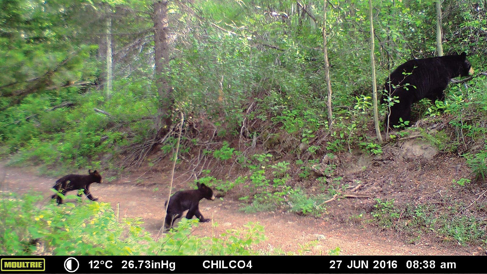
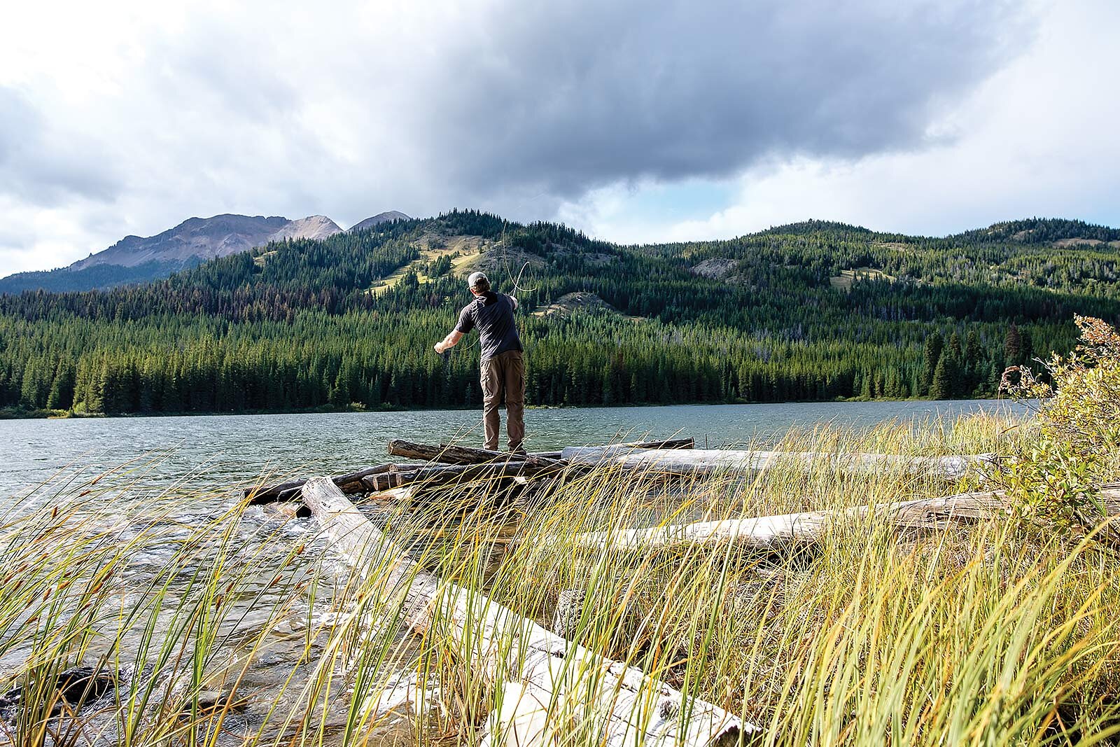
Designated a provincial park in 2001, the South Chilcotin Mountains and its plethora of trails had been a pseudo-secret Mecca for Hellinga and his ilk of backcountry mountain bikers for almost two decades. With the secret out, however, recreation demand had exploded and concerns about protecting the threatened grizzly bear population seemed to be in conflict. The land manager, BC Parks, urgently needed a design concept to manage recreational usage. Out of cell range, the park is a four-and-a-half-hour drive fromthe nearest BC Parks office and a five-hour drive from Whistler, including long stretches on rough, steep dirt roads. Park rangers hike, mountain bike and utilize the local float plane service to regularly access the park. Occasionally, they use helicopters, horseback and back- country skis, and in certain locations they have used ATVs and snow machines.
Getting anywhere within the park takes a lot of planning and organization to maximize the work that can be done with each shift, given that rangers are tasked with a broad portfolio that includes trail building and maintenance, public safety inspections and repairs, backcountry facility maintenance, compliance and enforcement, public relations, education, and interpretation. It can be hard to know what to prioritize.
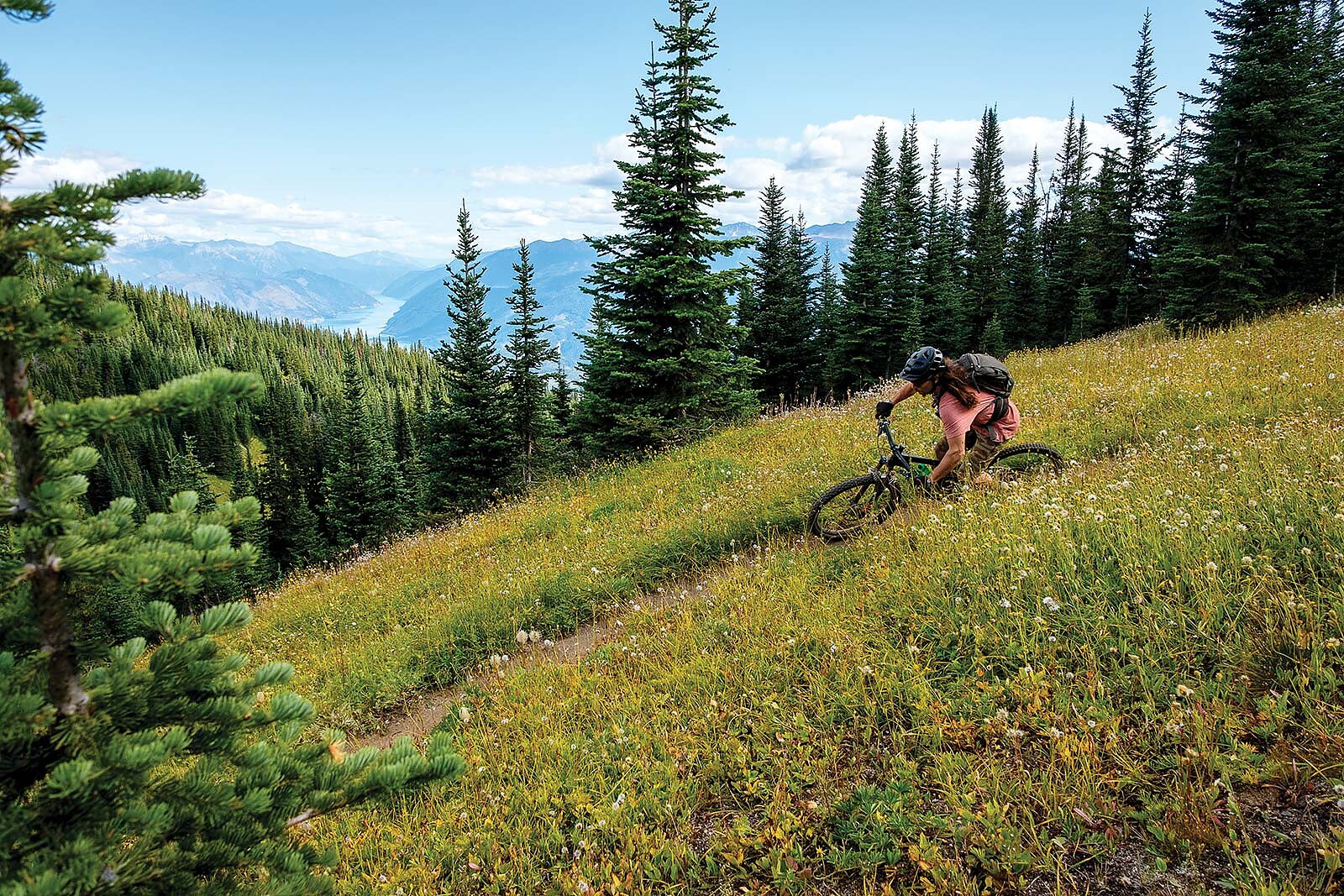
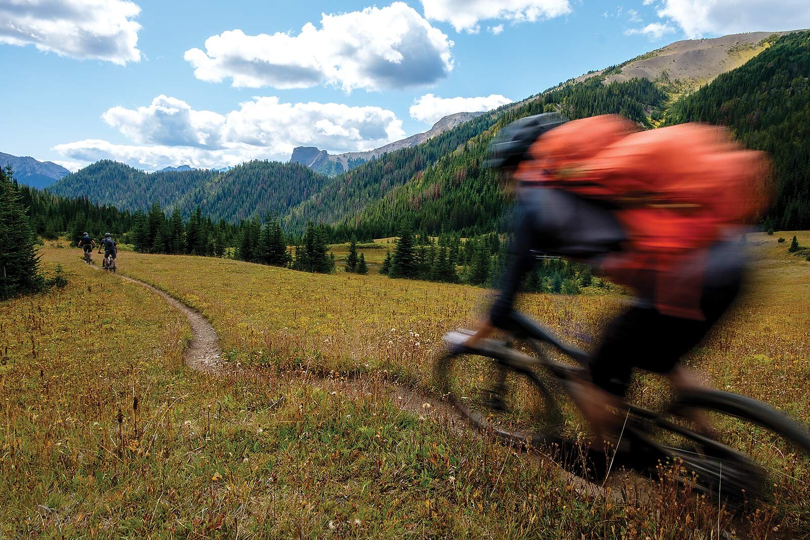
Barratt’s team’s mission was to be BC Parks’ eyes on the ground. They surveyed 90 miles of trails, 14 campgrounds, set up motion-detecting wildlife cameras at five trailheads and provided something that BC Parks was sorely in need of: objective opinions based on current assessments of existing conditions from experts in their field.
Too many meetings had been taking place in boardrooms far from the park, full of loud voices and conflict. Barratt and his colleague, landscape architect and mountain biker Annie Oja, reflected that when all the interest groups were sitting under the stars around a campfire, the conflicts wafted away.
“The media gave an impression that there was a lot of conflict, but we talked to all the different stakeholder groups and didn’t get that sense,” Oja says. “It was all very cordial and congenial.”
Some of the team’s recommendations would mitigate conflict simply by helping disperse people according to use. “There’s totally enough room out there,” she says. “There’s not even that many people using the park. There were just a few bottleneck points.”
The data was gathered all by mountain bike, with smart phones in hand. Hellinga led his Cascade Environmental team to customize a high-end GPS/GIS program, so the team could gather detailed information without even dis- mounting from their bikes.
“A bit of practice and it was easy to still stand on the bike,” Barratt says. “[You can] observe and record invasive plants, windfall, erosion and grizzly bear signs, tap the category, write a comment, take a picture and you are on your way.”
The coordinates, mapping, site descriptions and geo-referenced photos would all sync later, when an internet connection was secured, to a single database. In the time since the project wrapped three summers ago, the database and the app have continued to serve BC Parks as two of their most useful management tools. Park rangers use them to record trail issues. According to a spokesperson for the Ministry of Environment and Climate Change Strategy, which oversees BC Parks, “It’s also been vital for trailhead map development, mapping facility locations and planning trail reroutes around the park.”
Collecting the data by bike wasn’t mandated, but it was a stroke of genius. As described by Ministry officials, “It was an excellent way to move relatively quickly and easily across the park. Having the plan developers get out on the ground and see the landscape firsthand helped them understand the access routes, the logical rest stops and overnight camping locations and the location for critical trail signage.”
You can’t really understand the park as a whole unless you get out on the land, wade across rivers, camp in grizzly country, access alpine passes and hike-a-bike up mountain peaks. Because the final concept plan comes with this embedded intelligence of the developers’ professional expertise combined with on-the-ground perspective, BC Parks is now armed to “provide the best possible recreation experience while also conserving the many values this park contains.” A win-win for all users.
Several work plans have resulted from Barratt’s team’s findings. In the two seasons following its completion, BC Parks has in- stalled trailhead and float plane access kiosks, better food caches in all campgrounds, and new pit toilets and replacement of old toilets. They’ve also replaced all the float plane docks. Trail improvements include large reroutes, built-up sections of boardwalk and some new user-specific trails. BC Parks is looking at building a ranger station, as recommended, at Spruce Lake as well.
With the document in hand, they’re no longer flying blind or being pulled around by the loudest special interest group. In 2017, the plan won a National Award of Excellence from the Canadian Society of Landscape Architects. Equally satisfying for the bike nuts behind it, it’s being used as a blueprint to help manage one of the most beautiful and beloved places in the world to ride.